
Why Hikers Might Choose OnX Over AllTrails (And When They Shouldn’t)
Can a hunting app be better than AllTrails?
I’ve spent countless hours using both OnX and AllTrails across varied terrain. When people ask me which app they should use for hiking, I usually hit them with a question first: “What kind of hiking are you actually doing?”
OnX might surprise you when you’re hiking…and if you’re an AllTrails fan, having it as a backup is actually a really good idea.
Ok, what is OnX?
If you’re not familiar with OnX, it started as a hunting app designed to show property boundaries and help hunters navigate off-trail terrain. OnX was born in 2009 when Montana hunter Eric Siegfried got tired of not knowing exactly where he stood in the patchwork of public and private lands of the western United States. He had a vision for creating a system that would provide accurate location data with “plug-and-play simplicity” to support hunters and explorers navigating complex terrain.
The company started with a simple product – the OnX Chip that plugged into Garmin GPS units, showing hunters property boundaries they’d never been able to see before. For the first time, hunters could navigate with confidence, knowing exactly when they were crossing from public to private land. This might seem trivial to non-hunters, but trust me – it was revolutionary. Before OnX, we were stuck with paper maps, vague boundaries, and plenty of accidental trespassing.
Sound familiar – sounds like AllTrails for hikers! But, while OnX wasn’t built for hikers specifically, which is exactly why it offers capabilities that hiking-focused apps often lack.
In 2013 they launched their first mobile app and suddenly, all those paper maps, the need to have a Garmin, or worse, using your sense of direction and memory were no longer necessary. And hunting hasn’t been the same since. Today, the OnX suite includes OnX Hunt, OnX Offroad, and OnX Backcountry.
OnX Features
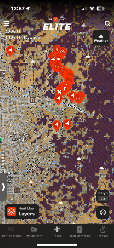
Today, OnX offers impressive coverage within the United States, with 852 million aces of public land mapped, 121 million private properties identified, almost 10,000 hunting units…and more than 650,000 miles of trails. You get 3D Mapping, imagery updates (every two weeks), and weather integration.
Interested, fellow hiker?
So, why do hunters like it? Key reasons…
- It shows exact property boundaries and ownership info – no more accidental trespassing or awkward conversations with landowners
- The offline maps actually work when you’re miles from cell service, which is basically everywhere worth hunting
- You can mark specific animal sign, trails, rubs, scrapes, or bedding areas with custom waypoints that stay year after year
- The 3D mapping lets you visualize terrain features before you’re standing in them – game-changing for planning approaches and identifying likely animal movement corridors
- The weather integration helps predict animal movement based on pressure changes, wind direction, and fronts moving through
- You can share exact locations with hunting partners without relying on vague descriptions or dropped pins that don’t work offline
- The satellite imagery is detailed enough to identify specific tree stands, clearings, and natural funnels from your couch before ever setting foot on the property
- It shows hunting unit boundaries and specific regulation zones so you always know which rules apply exactly where you’re standing
- The tracking feature creates breadcrumbs of your movement, helping you slip back out in the dark without blundering through bedding areasCustom waypoints stick around season after season, letting you build an increasingly detailed map of your hunting areas over time
Why Is it Good For Hiking?
First, it depends on the kind of hiking you are doing. If you are doing a public trail and going one-mile from the parking lot with the kids, OnX isn’t going to be world-changing for you. But, if you are going way into the trails, mile after mile, and want incredibly in-depth information about where you are – if you use it, OnX will become your go to.
Here’s why.
AllTrails has become like a social media platform – people go in, put their reviews, they take their photos and upload them, and soon, you’re taking someone else’s hike instead of your own. If you’re like me and you want to get out in the way back and begin looking at things off trail – OnX will change your world. Every trail that you find on AllTrails – it’s on OnX. If it’s a public trail of any kind, it’s on OnX. Difference is, you’re going to get a massive amount of information about the trail you’re on in an easy to use interface.
The other thing I don’t like, and I show it in the video – I do not like how the trail system works on AllTrails. If I am looking for a trail, which I show, and I can’t find it on AllTrails – you’re SOL. OnX will have it and then some. Unlike apps limited to established trails, OnX excels at creating custom routes. You can connect multiple trails, mark specific waypoints, and build personalized adventures beyond what’s already mapped. There is a large amount of icons you can place on the map, as well as place waypoints and describe the waypoints quickly and easily. Build your own routes, the spots you want to go back to, and don’t worry about them being share publicly – it’s on your app, not everyone else’s.
Waypoint management is a breeze. Create, organize, and share detailed waypoints with customizable icons and notes – perfect for marking a route, camping spot, water sources, photo spots, campsites, or hazards, and whatever else you want – or just put your own notes in. Then – share it with a friend, or save it for yourself.
For backcountry and camping, it’s incredible. The hybrid satellite view combines actual terrain imagery with topographic lines simultaneously – invaluable when navigating off-trail or on faint paths. It’s built for going into the backcountry, pushing beyond the AllTrails clearly defined well traveled trail, and going to look for a camping stop. You can toggle between different specialized base layers depending on your needs – need to find shade in the trees, turn on that layer. Want to make sure you aren’t camping on someone’s property – turn on the layer. The layering system is easy to use and built for those going a little further than the AllTrails maps
The app records your actual path with detailed metrics, allowing you to share routes or retrace your steps precisely. No random green dot – you place a dot, you get the elevation, everything about it. I really like this – when it gets dark and you have to get back to the parking lot, OnX has your back. It’s built for itto get you back.
Lastly – layout your route at home, on your desktop – plan it all out sitting at home – or review it all when you get home. All your custom routes, waypoints, and tracked paths sync across devices when connected – create routes on your computer and access them on your phone in the field or get home and review it all and look for a new way to go next time hiking a game trail you found and market.
Have a spot you want to drive to – go for it.
Where does it fall short?
This isn’t AllTrails – it doesn’t list exactly how to get to a trailhead, or details about ‘a kiosk marks the beginning off a Fire Break road.’ It won’t tell you the elevation gain vs. length, which I actually like a lot about AllTrails. OnX doesn’t tell you if there are facilities. It won’t tell you ground conditions or mosquitoes. These are important for some people, which I get.
There is a balance here – you don’t get those things. You won’t find out if a trail is dog friendly. You won’t be given a (usually inaccurate) length of the trail or how long it takes to do the trail (also inaccurate). You also won’t find out someone saw a bee and butterflies on their hike, or someone complaining about things like ‘too many people with hiking poles’.
But, if you do it right – you look up a trail ahead of time when you choose one, you will know if it’s dog friendly, you will know if there is a bathroom, etc. You should do this anyway any trail you’re going on – the number of times AllTrails has been wrong for me, I take it as a guide, not as gospel.
The Rating – 4.5 Thumbs.
Ok, I’ve given you so much information on this post, if you’re still reading, you may need the OnX to find your way back to the rating! But, we want to be thorough, right? So, the 5F’s – let’s get to the rating.
Form – 5
OnX’s interface feels more professional and data-rich than AllTrails’ social media-style layout. It’s not busy, you can clearly get to what you want. I like not having everyone’s complaints on the app – I’m here to hike, not learn you saw a butterfly. The layered mapping system with customizable icons creates a technical appearance that appeals to serious backcountry users rather than casual trail followers, so the layers will becoming confusing to you as a hiker if you don’t know what you really doing.
Fit – 5
For hikers who venture beyond established trails and want detailed terrain intelligence, OnX fits perfectly. The app excels when you need property boundaries, custom route building, and comprehensive offline functionality, but it’s overkill for simple day hikes on popular trails at a public trail.
Function – 4.5
OnX delivers superior waypoint management, comprehensive offline maps, property boundary data, and custom route creation that AllTrails simply can’t match. Here is where I will ding it a half-thumb – the layers, it can be confusing. For hunters, it’s invaluable, but still hard to decipher when you have layers on and how they operate. For hikers, most of the layers will not be of value. With pricing from $34.99 for single-state Premium to $99.99 for nationwide Elite coverage onX Hunt it provides functionality that transforms how serious hikers navigate backcountry terrain.
Field Performance – 5
The offline reliability and detailed terrain visualization consistently outperform AllTrails when cell service disappears and navigation becomes critical. I have run in to this multiple times, I even demonstrate it in the video in this post. Property boundary accuracy and 3D mapping prove invaluable for route finding in complex terrain where traditional hiking apps leave you guessing.
Financial Investment – 5
At $35-100 annually depending on coverage needs, OnX represents excellent value for hikers who regularly venture into remote areas or need detailed land ownership information, though casual trail hikers will find AllTrails’ community features worth the lower cost. AllTrails is less expensive and it reflects it in its features. It’s for basic hikers, not backcountry longhauls.
In conclusion – get the free version, watch some Youtube videos to learn it, and try it out. My guess is that you will blend free AllTrails for known trail knowledge on easy day hikes and full-price OnX for a variety of tasks.